
Ground Penetrating Radar (GPR) is a non-invasive subsurface imaging technique that has become an increasingly popular tool for geologists, archaeologists, engineers, and other professionals. This technology uses high-frequency electromagnetic waves to produce detailed images of the subsurface layers, providing valuable information about buried objects, structures, and geological features. In this article, we will take a closer look at the principles of GPR, its applications, and its advantages over traditional subsurface exploration methods. We will also explore some case studies and discuss the potential for future advancements in this powerful technology. Whether you are a professional in a related field or simply curious about the capabilities of GPR, this article will provide a comprehensive overview of all things ground penetrating radar
Table of Contents
How does a Ground Penetrating Radar (GPR) Work?

Ground Penetrating Radar (GPR) is a non-invasive geophysical technique used for subsurface investigation. It can be described as a type of radar technology that is used to detect and map underground features by sending high-frequency electromagnetic pulses into the ground and then analyzing the reflected signals.
The technology behind GPR is based on the principle of radio waves and how they interact with different materials in the ground. A GPR system consists of three main components - a control unit, an antenna, and a recording device.
The control unit is typically a laptop or tablet that runs specialized software and controls the operation of the GPR system. The antenna is the main component responsible for sending and receiving the electromagnetic pulses. It is connected to the control unit through a cable and can be either ground-coupled or air-launched.
The first step in using GPR is to collect the data by moving the antenna over the area of interest in a grid pattern. As the antenna emits high-frequency pulses, some of the energy is absorbed by the ground, and some of it is reflected back to the antenna. The speed at which the pulses travel and the amount of energy reflected back can provide information about the material properties and the objects buried in the ground.
Different materials in the subsurface have different electrical properties, and these properties affect the way radio waves travel through them. For example, materials with high electrical conductivity, such as metals, will reflect more energy back to the antenna compared to low-conductivity materials like soil or rock.
The reflected pulses are then received by the antenna and sent back to the control unit for processing. The signals are converted into 2D or 3D images, which can be interpreted by a trained operator. The recorded data can also be analyzed using different software to enhance the images and extract more detailed information about the subsurface.
GPR can detect different types of features, such as buried utilities, pipes, voids, and even archaeological artifacts. It can also provide information about the depth and thickness of layers in the subsurface, making it a valuable tool for a wide range of applications, including geological mapping, environmental site investigation, and infrastructure inspection.
In summary, GPR works by sending and receiving high-frequency electromagnetic pulses into the ground to detect and map subsurface features and materials. Its non-invasive and versatile nature makes it an essential tool for various industries and applications.
Working Principle of Ground Penetrating Radar (GPR)

Ground Penetrating Radar (GPR) is a geophysical method used for subsurface investigation. It is based on the principle of transmitting high-frequency electromagnetic signals into the ground and measuring the reflections from subsurface features and interfaces. This technology is widely used in civil engineering for applications such as locating utilities, detecting buried objects, and assessing the condition of pavement and concrete structures.
The working principle of GPR is based on the propagation of electromagnetic waves in the ground. These waves are generated by the GPR system and transmitted into the ground through a transmitting antenna. The frequency of these waves typically ranges from 10 MHz to 2.6 GHz, with higher frequencies providing better resolution but limited penetration depth, while lower frequencies have lower resolution but can penetrate deeper into the ground. The transmitting antenna can be either a single antenna or an array of antennas, depending on the specific application.
When the electromagnetic waves reach the subsurface, they interact with various subsurface materials such as soil, rocks, and buried objects. This interaction causes the waves to partially reflect, refract, and diffract. The reflected waves travel back to the ground surface and are received by a receiving antenna. The time it takes for the waves to travel from the transmitter to the subsurface features and back to the receiver is recorded and plotted as a graph called a radargram.
The amplitude of the reflected wave is affected by the dielectric properties of the subsurface materials, which is a measure of how easily they allow the electromagnetic waves to pass through. Materials with higher dielectric properties, such as water or metallic objects, will reflect more energy compared to materials with lower dielectric properties, such as air. This difference in amplitude is what allows for the identification and location of subsurface features.
The shape, amplitude, and timing of the reflected waves on the radargram can provide valuable information about the subsurface features, such as the depth, size, and orientation of buried objects, and the condition of pavement or concrete structures. GPR data can also be processed and interpreted using advanced software to create 3D images of the subsurface features, providing a clearer understanding of the subsurface conditions.
One of the main advantages of GPR is its non-intrusive nature, as it does not require drilling or excavation to obtain subsurface information. It is also relatively quick and cost-effective compared to traditional methods of subsurface investigation. However, the accuracy and resolution of GPR data can be affected by factors such as soil conditions, presence of water, and high electrical conductivity of the subsurface materials.
In conclusion, the working principle of GPR revolves around the transmission and reception of electromagnetic waves to gather information about the subsurface conditions. This non-destructive technology has revolutionized the way civil engineers investigate and map subsurface features, making it an essential tool for various applications in the field of civil engineering.
Data Collection in Ground Penetrating Radar (GPR)

Ground Penetrating Radar (GPR) is a non-destructive geophysical method that uses high frequency electromagnetic waves to penetrate and map subsurface features. It has a wide range of applications in civil engineering, including infrastructure assessment, utility detection, and concrete scanning. Data collection is a critical aspect of GPR surveys as it dictates the accuracy and reliability of the results. In this article, we will discuss the various aspects of data collection in GPR and its importance in civil engineering.
1. Planning and Preparation:
The first step in data collection for GPR is to plan and prepare for the survey. This involves understanding the objectives of the survey, selecting the appropriate equipment and antennas, and determining the survey area and scanning pattern. The quality of data collected will depend on the accuracy of these initial steps.
2. Calibration and Setup:
Before starting the survey, it is important to calibrate the GPR equipment. This involves adjusting the parameters such as gain, frequency, and time window to ensure accurate data collection. The setup process also includes connecting the antennas to the GPR unit and performing a system check to ensure everything is functioning properly.
3. Data Acquisition:
The GPR data is collected by transmitting high-frequency electromagnetic waves into the ground and recording the echoes that are reflected back from the subsurface features. The data is collected in a transect pattern, with the antennas moving in a straight line while maintaining constant speed and antenna height from the ground.
4. Real-Time Processing:
Many modern GPR systems have the capability of real-time data processing, which allows for immediate data interpretation and analysis. This is especially useful in field surveys where quick decisions need to be made.
5. Data Interpretation:
The collected data is then analyzed and interpreted to identify subsurface features. This can be done using various software programs, where the data is processed and displayed in 2D or 3D images. Manual interpretation may also be necessary in some cases.
6. Post-processing:
Post-processing involves cleaning and filtering the data to remove any noise or interference and enhance the signal. This ensures that only relevant data is used for further analysis.
7. Documentation:
It is crucial to document all steps of the GPR survey, including equipment used, survey parameters, data collected, and results. This documentation is necessary to ensure data integrity and can be useful for future reference.
Importance of Data Collection in GPR:
1. Accuracy and Reliability:
The accuracy and reliability of GPR results depend greatly on the quality of data collected. Proper planning, calibration, and setup are essential for collecting accurate data, which in turn leads to reliable results.
2. Cost and Time Efficiency:
Efficient data collection can save time and money in the long run. Proper planning and real-time processing can help in identifying potential issues quickly, which allows for timely decision making and avoids costly mistakes.
3. Safety:
GPR is often used in infrastructure assessment, where accurate data is critical to ensure the safety of structures. Accurate data collection can help in identifying potential hazards and prevent accidents.
In conclusion, data collection is a vital part of GPR surveys and requires careful planning, calibration, and execution to ensure accurate and reliable results. With the advancements in technology, GPR has become an indispensable tool for civil engineers, and proper data collection techniques are essential for its successful implementation in various projects.
Features of Ground Penetrating Radar (GPR)

Ground Penetrating Radar (GPR) is a remote sensing technique that uses high-frequency electromagnetic waves to detect and map subsurface features. This technology has become an essential tool for civil engineers in the field of geotechnical and environmental investigations. GPR offers a non-destructive and non-intrusive method of subsurface imaging, making it a safe and efficient option for underground exploration.
Some of the key features of Ground Penetrating Radar are:
1. Penetration depth: One of the most significant features of GPR is its ability to penetrate through various materials and detect features at depths of up to 30 meters, depending on the soil conditions and antenna frequency used. It can detect features such as underground utilities, voids, and bedrock, which are crucial for construction projects.
2. Versatility: GPR can be used on various types of surfaces such as concrete, asphalt, soil, and even ice. It is a versatile technology that can be easily adapted to different site conditions, making it suitable for a wide range of applications.
3. Resolution: GPR offers excellent resolution, allowing for the detection of small and subtle subsurface features. The resolution depends on the frequency of the antenna used, with higher frequencies providing better resolution but lower penetration depth.
4. Real-time data: GPR provides real-time data, which means it can immediately detect and display subsurface features as the data is being collected. This feature allows for quick decision-making on site and reduces the need for additional investigations.
5. Non-invasive: GPR is a non-intrusive method that does not require excavation or drilling, making it a safe and cost-effective option. It also reduces the risk of damage to existing structures or utilities during investigations.
6. Cost-effective: GPR is relatively cost-effective when compared to other traditional geotechnical and environmental investigation methods. With its ability to provide detailed and accurate data in a shorter timeframe, GPR can help save project costs in the long run.
7. Environmental-friendly: GPR does not use any harmful chemicals or emit any radiation, making it an environmentally-friendly option for subsurface exploration.
In conclusion, the features of Ground Penetrating Radar make it an indispensable tool for civil engineers in site investigations. It provides valuable data that helps in decision-making and reduces project risks and costs. As technology continues to advance, GPR is also expected to improve in terms of accuracy, speed, and versatility, making it an even more essential tool in civil engineering.
Penetration Depth of GPR
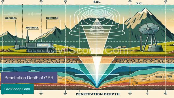
Penetration depth of Ground Penetrating Radar (GPR) refers to the maximum distance that the electromagnetic (EM) waves can travel through a material and still provide usable data. GPR is a non-destructive testing method used for subsurface investigation, mapping and monitoring of various engineering structures.
The depth of penetration of GPR depends on many factors such as the frequency of the EM waves, the dielectric properties of the material being investigated, and the antenna design. Generally, the higher the frequency of the EM wave, the shallower the depth of penetration.
The dielectric properties of the material also play a significant role in determining the maximum penetration depth. Materials with low dielectric constant, such as air and sand, allow the EM waves to travel deeper compared to materials with high dielectric constant, such as concrete and rocks. This is because materials with high dielectric constant absorb more of the EM waves, reducing its ability to penetrate deeper.
The antenna design of GPR also affects the depth of penetration. The two common types of antennas used in GPR are air-coupled antennas and ground-coupled antennas. Air-coupled antennas are used to detect shallow targets, while ground-coupled antennas can penetrate deeper into the ground.
The depth of penetration in GPR can range from a few centimeters to several meters. Low-frequency GPR systems (100-300 MHz) are suitable for deep subsurface investigations up to 30 meters, while high-frequency systems (900-2700 MHz) are more suited for shallow investigations up to 5 meters. Generally, the deeper the penetration, the lower the resolution of the data.
The type of material being investigated also affects the penetration depth. For example, GPR can easily penetrate through dry sand, but it may struggle to penetrate through wet soils or clay due to their high conductivity.
To improve the penetration depth of GPR, different techniques are used, such as using ground-penetrating transmitter and receiver antennas of different frequencies, GPR arrays, or using GPR in combination with other geophysical methods like seismic reflection.
In conclusion, the penetration depth of Ground Penetrating Radar varies depending on various factors such as frequency, antenna design, and material properties. Understanding these factors and selecting the appropriate GPR system is crucial to obtain accurate and reliable data for subsurface investigations.
Conclusion
In conclusion, ground penetrating radar technology has revolutionized the way we study and understand the world beneath our feet. This non-destructive and highly accurate method has proved to be an invaluable tool in various fields such as archeology, engineering, and utility detection. Its ability to create detailed images of subsurface structures and objects has allowed for more efficient and cost-effective data collection and analysis. As technology continues to advance, we can expect ground penetrating radar to become even more versatile and widely used in various industries. With its many applications and benefits, it is evident that ground penetrating radar will continue to play a crucial role in uncovering the mysteries hidden beneath the surface.